PREVIOUS
✖
Geospatial Systems in Governance
May 5 , 2026
15 hrs 0 min
7
0
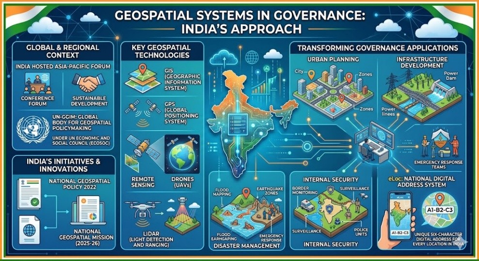
- India hosted the Asia-Pacific Forum on advancing geospatial systems for sustainable development.
- Geospatial systems use tools like GIS (Geographic Information System), GPS (Global Positioning System), remote sensing, drones, and Light Detection and Ranging (LiDAR).
- The United Nations Committee of Experts on Global Geospatial Information Management (UN-GGIM) is the global body for geospatial policymaking under the UN Economic and Social Council.
- These systems help in urban planning, infrastructure development, disaster management, and internal security.
- Government initiatives include National Geospatial Policy 2022 and National Geospatial Mission (2025-26).
- eLoc is a National Digital Address System that provides a unique six-character digital address for every location in India.

Leave a Reply
Your Comment is awaiting moderation.