PREVIOUS
✖
Mercator map of Earth
August 28 , 2025
16 hrs 0 min
18
0
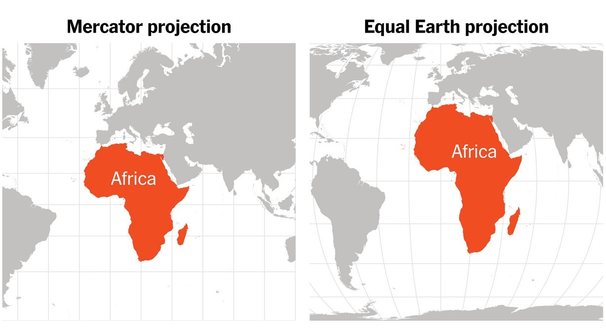
- The African Union (AU) has endorsed the ‘Correct the Map’ campaign to replace the Mercator map projection with alternatives such as the Equal Earth map.
- The Mercator projection widely used in schools, media, and online platforms.
- It systematically distorts the sizes of landmasses, shrinking Africa while inflating Europe, North America, and Greenland.
- The Mercator projection was designed in 1569 by Flemish cartographer Gerardus Mercator, who was trying to solve a navigation problem.
- When a ship follows a fixed compass direction, the path it traces – called the rhumb line – is a curve on most flat maps.
- Mercator’s projection stretched the north-south scale so that all rhumb lines appeared as straight lines.
- Mercator distorted scale means, landmasses close to the poles appeared larger while those near the equator appeared smaller than in reality.
- As a result, Africa, which covers 30 million sq. km, often appears on Mercator maps roughly as large as Greenland, which is 14x smaller.
- Europe also looks comparable in size to Africa although the continent is a third as large.
- Similarly, Canada, Russia, and northern Europe appear bloated while tropical regions like Africa, South America, and India are diminished.
- The alternative to the Mercator projection - Equal Earth projection was created in 2018.
- Another option is the Gall-Peters projection repopularised in the 1970s.

Leave a Reply
Your Comment is awaiting moderation.