PREVIOUS
✖
Stubble Burning Status Report 2025
December 12 , 2025
15 hrs 0 min
15
0
- The International Forum for Environment, Sustainability and Technology (iFOREST) released the Stubble Burning Status Report 2025 for northwest India.
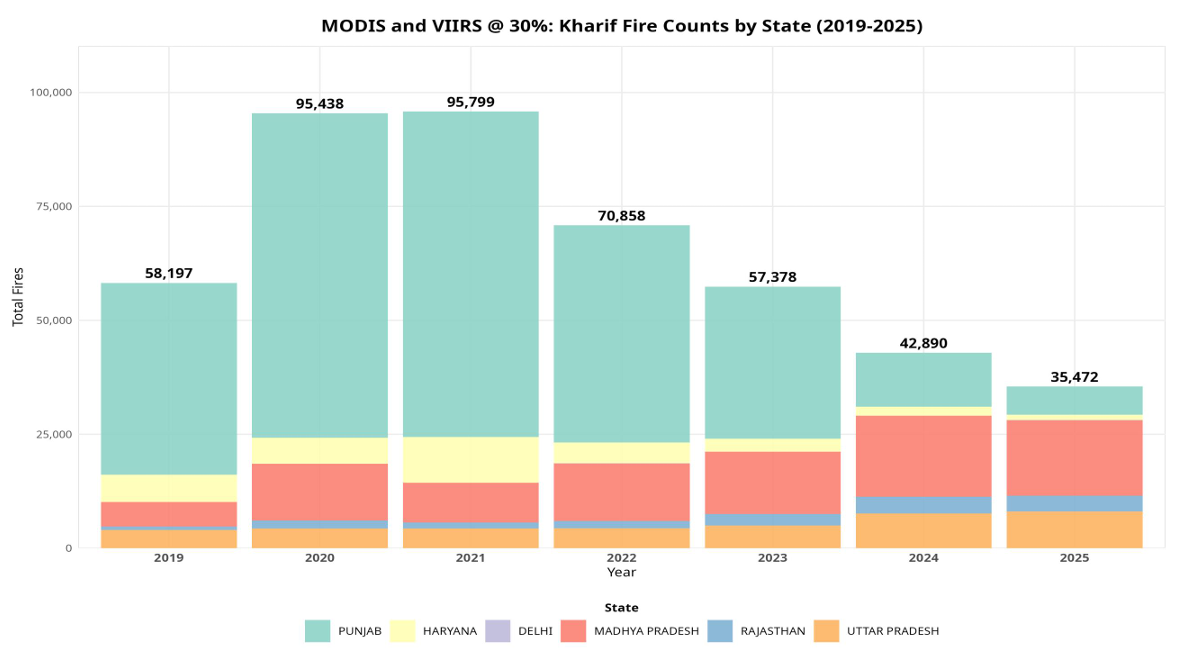
- India’s monitoring system, run by CREAMS (Consortium for Research on Agroecosystem Monitoring and Modelling from Space) at IARI (Indian Agricultural Research Institute), misses many farm fires.
- The system depends mainly on two polar-orbiting satellite sensors:
- Moderate Resolution Imaging Spectroradiometer (MODIS) and
- Visible Infrared Imaging Radiometer Suite (VIIRS).
- MODIS and VIIRS capture fires only between 10:30 AM and 1:30 PM, which misses most late-afternoon burning.
- Spinning Enhanced Visible and Infrared Imager (SEVIRI) 15-minute data show that over 90% of large fires in Punjab in 2024–2025 occurred after 3:00 PM.
- In Haryana, most large fires have been happening after 3:00 PM since 2019, meaning an underestimation for several years.
- Sentinel-2 Multispectral Instrument (MSI) burnt-area mapping shows Punjab’s burnt area fell from 31,447 km² (2022) to about 20,000 km² (2025).
- Haryana’s burnt area fell from 11,633 km² (2019) to 8,812 km² (2025) but has fluctuated without a steady decline.
- Actual burnt-area reductions (25–35%) are much smaller than reductions suggested by active fire counts (>90%), proving major monitoring gaps.

Leave a Reply
Your Comment is awaiting moderation.