PREVIOUS
✖
Landslide Atlas of India
March 18 , 2023
1211 days
2664
0
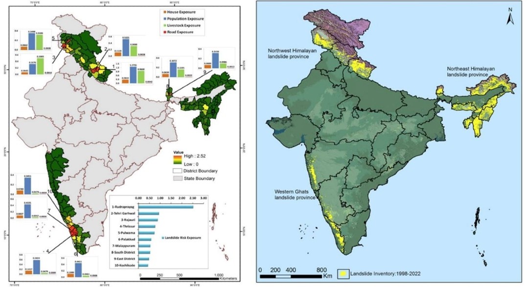
- The National Remote Sensing Centre (NRSC), Hyderabad under the Indian Space Research Organisation (ISRO) has released the Landslide Atlas of India.
- The team released a list of 147 most landslide-vulnerable districts in 17 states and two Union Territories.
- Rudraprayag and Tehri Garhwal districts of Uttarakhand have the highest landslide density and landslide risk exposure in the country.
- Chamoli district of Uttarakhand, where Joshimath is grappling with a land-subsidence crisis, has been ranked 19th.
- Haridwar and Udham Singh Nagar figure at the bottom at 146th and 147th, respectively.
- Apart from Uttarakhand, among the 10 most landslide-prone districts, four are in flood-prone areas of Kerala, two in Jammu and Kashmir and two in Sikkim.
- After the Himalayas, the Western Ghats has high landslide density.

Leave a Reply
Your Comment is awaiting moderation.